

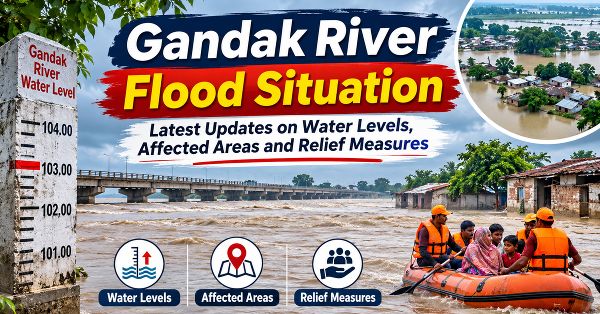
The Gandak River is one of the most important rivers flowing through Bihar and parts of Uttar Pradesh. It plays a significant role in agriculture, irrigation, drinking water supply and the daily lives of millions of people. However, during the monsoon season, the river can also become a major source of concern due to rising water levels and the possibility of flooding in nearby villages and low-lying areas.
The flood situation near Gandak River is closely monitored by government authorities, particularly in districts located along its banks. Changes in rainfall patterns, water discharge from upstream areas of Nepal, and the condition of embankments can influence the river’s water level.
As of November 2, 2026, the latest available official water-level readings from November 1 provide useful information about the river’s condition at several monitoring stations. While these readings offer encouraging signs at the observed locations, residents should continue to follow official advisories and remain prepared for any changes.
Table of Contents
Latest Gandak River Flood Update
The Bihar Water Resources Department regularly monitors the water levels of major rivers across the state, including the Gandak River. These observations help authorities understand river conditions and take necessary steps to manage potential flood risks.
According to the Water Resources Department’s water-level observations dated November 1, 2026, at 2 PM, the Gandak River was below the danger level at the listed monitoring stations.
| Monitoring Station | Current Water Level | Danger Level | Status |
| Chatia, East Champaran | 65.68 m | 69.15 m | Below danger level |
| Dumariaghat, Gopalganj | 61.20 m | 62.22 m | Below danger level |
| Hajipur, Vaishali | 46.56 m | 50.32 m | Below danger level |
| Rewaghat, Muzaffarpur | 51.35 m | 54.41 m | Below danger level |
Source: Bihar Water Resources Department, November 1, 2026, 2 PM observations. Official water-level report.
These readings indicate that the water level remained below the official danger mark at the four reported stations. Dumariaghat was comparatively closer to its danger level than the other listed locations.
It is important to understand that river levels can change rapidly due to rainfall in Nepal and upstream catchment areas. Therefore, the latest readings should not be treated as a guarantee that flooding cannot occur.
Residents living near riverbanks should stay alert and regularly check official updates.
Flood Situation Near Gandak River: Affected Areas
The river flows through several districts of Bihar and Uttar Pradesh. During periods of heavy rainfall or increased upstream discharge, low-lying settlements and agricultural areas near the river may face flood-related challenges.
Some important districts and locations associated with the Gandak River include:
- West Champaran
West Champaran is one of the important districts located along the Gandak River system. The Valmikinagar area is particularly significant because of the presence of the Gandak Barrage.
Villages near the river and low-lying agricultural areas may require monitoring during periods of heavy rainfall.
- East Champaran
Parts of East Champaran are connected to the Gandak river basin. Areas near Chatia and surrounding locations are monitored for changes in river levels.
- Gopalganj
Gopalganj is an important district in the Gandak flood-monitoring network. Dumariaghat is one of the major monitoring stations in this district.
Because some areas are located near the river, changes in water levels can affect local transportation, farming and daily activities.
- Muzaffarpur
The Rewaghat monitoring station is located in Muzaffarpur district. Residents in river-adjacent areas should remain aware of official flood advisories, particularly during the monsoon season.
- Saran and Vaishali
The Gandak continues towards its confluence with the Ganga near the Hajipur region. Areas around Saran and Vaishali may also be affected by changes in river flow and water levels.
Important: These are districts associated with the Gandak River and its monitoring system. This does not mean that every listed district is currently experiencing active flooding. The actual flood impact depends on local conditions, water levels, rainfall and official assessments.
Gandak River Map: Route and Important Locations
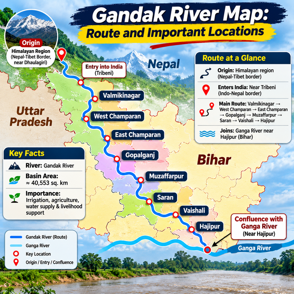
The river is an important Himalayan River that flows through Nepal and northern India.
The river enters Indian territory near the Indo-Nepal border in the vicinity of Tribeni. It then flows through the plains of Bihar, forming parts of the boundary between Bihar and Uttar Pradesh before continuing towards the Ganga.
The Gandak River map highlights its route through important regions such as:
- Valmikinagar
- West Champaran
- East Champaran
- Gopalganj
- Muzaffarpur
- Saran
- Vaishali
- Hajipur
The river eventually joins the Ganga near Hajipur, opposite the Patna region.
The Gandak basin has a total drainage area of approximately 40,553 square kilometres. A significant part of the basin lies in Nepal, which makes coordination between upstream and downstream authorities important for flood management.
Gandak River Origin: Where Does It Start?
The river originates in the Himalayan region near the Nepal-Tibet border, northeast of Dhaulagiri.
In its upper reaches, the river is known by different names, including Kali Gandaki and Narayani in Nepal. It receives water from several Himalayan tributaries before entering the plains of northern India.
The river origin is important to understanding its flood behavior. Since a large part of its catchment area lies in the Himalayan region, rainfall and weather conditions in Nepal can influence water discharge downstream in Bihar.
During the monsoon, heavy rainfall in the upper catchment may lead to increased river flow. This is one reason why authorities in Bihar closely monitor river levels and discharge information from upstream locations.
Why Does the Gandak River Cause Flooding?
Several factors can contribute to flooding near the river.
Heavy Rainfall in Nepal
The Gandak basin receives substantial rainfall during the monsoon season. Heavy rainfall in Nepal’s mountainouscatchmentcan increase the amount of water flowing into the river.
Rising Upstream Discharge
Water released or flowing from upstream locations can increase the river’s discharge. This may influence water levels in downstream districts of Bihar.
Low-Lying Areas
Some villages, agricultural lands and settlements are located close to the river. These areas may be more vulnerable when water levels rise.
Silt Deposition
The Gandak carries sediment from the Himalayan region. Over time, sediment can accumulate in the riverbed, affecting its capacity to carry water and increasing the possibility of overflowing in certain stretches.
Embankment Conditions
Embankments help protect nearby settlements and agricultural areas. However, regular inspection and maintenance are essential to ensure their effectiveness.
Gandak River Bihar: Importance for Agriculture and Daily Life
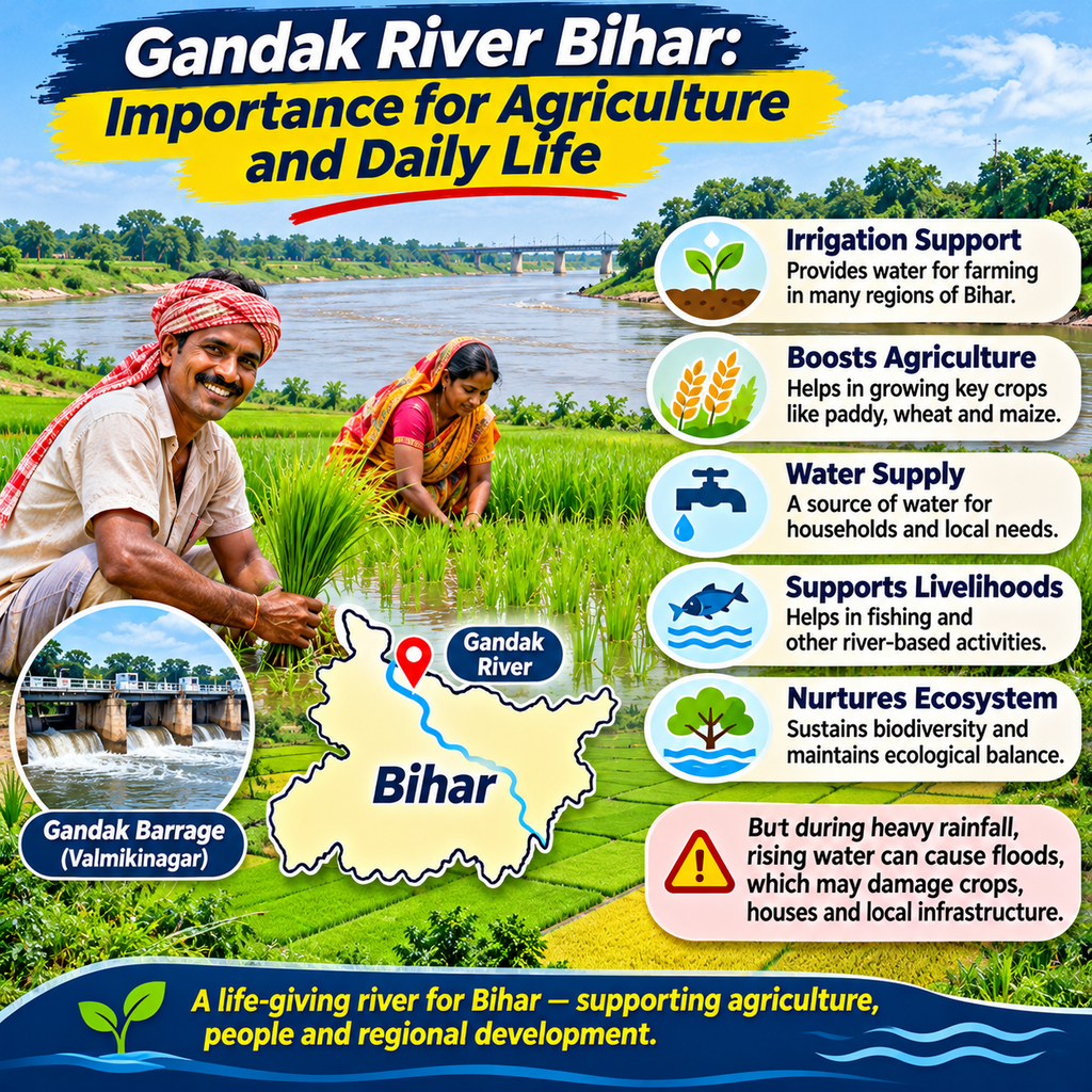
The river has a major role in the economy and development of Bihar.
It supports irrigation facilities, agriculture, water supply and several local activities. Farmers in areas near the river depend on its water for cultivating crops.
The river also supports local ecosystems and provides water resources for communities.
However, excessive water flow during the monsoon can create challenges. Flooding may damage crops, affect roads, disrupt transportation and temporarily impact access to essential services.
A balanced approach to river management is therefore necessary. Proper irrigation planning, embankment maintenance, flood forecasting and public awareness can help communities benefit from the river while reducing risks.
Latest Relief Measures and Flood Management
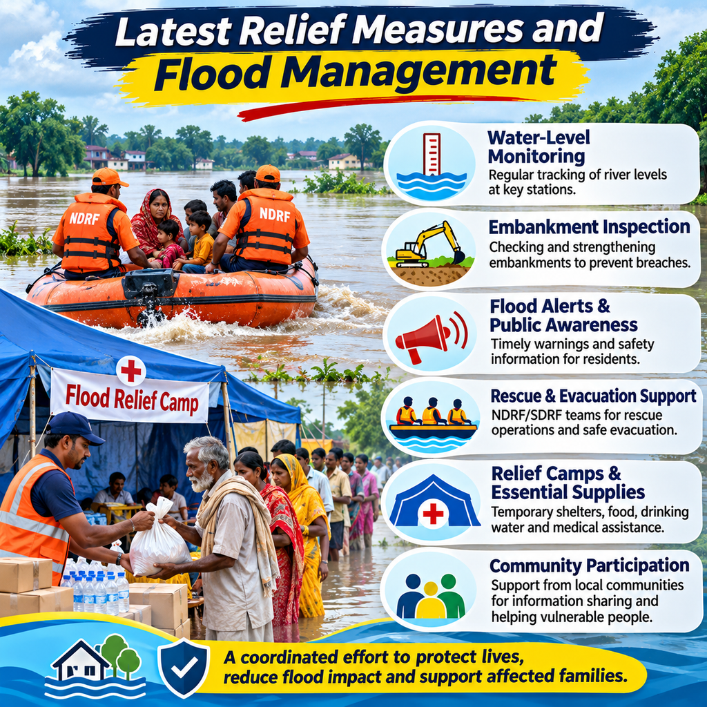
Flood management near the river involves coordination between government departments, local authorities and disaster-response teams.
Some of the important measures used during flood-risk periods include:
Water-Level Monitoring:
Authorities monitor water levels at several river stations to identify changes and issue alerts when required.
Embankment Inspection:
Regular inspection of embankments helps identify weak sections and allows maintenance work to be undertaken where necessary.
Flood Alerts and Public Awareness:
Local authorities may issue warnings to residents in vulnerable locations. These alerts help people prepare for possible evacuation or other safety measures.
Rescue and Evacuation Support:
When flooding affects settlements, disaster-response teams may assist with evacuation and rescue operations.
Relief Camps and Essential Supplies:
Depending on the severity of the situation, local administrations may arrange temporary shelters, food, drinking water, medical support and other essential supplies for affected residents.
Community Participation:
Local communities can play a valuable role by sharing information, supporting vulnerable residents and following instructions from authorities.
Safety Tips for People Living Near the Gandak River:
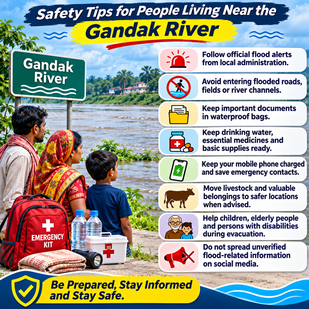
Residents living near the river should take a few important precautions during periods of rising water levels:
- Follow official flood alerts issued by local administration.
- Avoid entering flooded roads, fields or river channels.
- Keep important documents in waterproof bags.
- Store drinking water, essential medicines and basic emergency supplies.
- Keep mobile phones charged and emergency contacts accessible.
- Move livestock and valuable belongings to safer locations when advised.
- Avoid crossing rivers or streams with strong currents.
- Help children, elderly people and persons with disabilities during evacuation.
- Do not spread unverified flood-related information on social media.
Conclusion
The Gandak River remains an important natural resource for Bihar and Uttar Pradesh, supporting agriculture, irrigation and the livelihoods of many communities. At the same time, its Himalayan origin and monsoon-driven flow make regular flood monitoring essential.
The latest available official observations from November 1, 2026, showed that the river was below the danger level at Chatia, Dumariaghat, Hajipur and Rewaghat. These readings offer useful information about the river’s condition at the monitored locations, although water levels can change depending on rainfall and upstream discharge.
Residents should continue to follow official updates from the Bihar Water Resources Department and local administration.
With timely information, effective relief measures, proper embankment maintenance and community preparedness, the risks associated with flooding can be managed more effectively. Staying informed and taking precautionary steps remain the best ways to protect lives and property.
Frequently Asked Questions (FAQ’s):
1. What is the latest flood situation near Gandak River?
As per the Bihar Water Resources Department’s November 1, 2026, water-level report, the river remained below the danger level at Chatia, Dumariaghat, Hajipur and Rewaghat monitoring stations.
2. Which districts of Bihar are located near the Gandak River?
The river flows through or is associated with districts such as West Champaran, East Champaran, Gopalganj, Muzaffarpur, Saran and Vaishali.
3. Where does the Gandak River originate?
The river originates in the Himalayan region near the Nepal-Tibet border, northeast of Dhaulagiri.
4. Where does the Gandak River join the Ganga?
The river joins the Ganga near Hajipur in Bihar, opposite the Patna region.
5. Why does the Gandak River cause floods in Bihar?
Flooding may occur due to heavy rainfall in Nepal, increased upstream water discharge, sediment deposition, low-lying terrain and embankment-related issues.
6. What is the danger level of the Gandak River at Dumariaghat?
According to the November 1, 2026, report, the danger level at Dumariaghat was 62.22 metres, while the observed water level was 61.20 metres.
7. How can people check the Gandak River water level?
People can check river water-level information through the Bihar Water Resources Department’s official website and local administration updates.
8. What relief measures are provided during Gandak River floods?
Relief measures may include rescue operations, evacuation support, temporary shelters, food supplies, drinking water, medical assistance and flood alerts.
9. Is the Gandak River important for agriculture in Bihar?
Yes. The river supports irrigation, agricultural activities and water resources in several regions of Bihar.
10. What precautions should people take during a Gandak River flood?
People should follow official warnings, avoid flooded areas, keep emergency supplies ready, protect important documents and move to safer locations when instructed by authorities.


